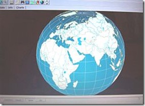
You may not have heard of this app but it’s a virtual globe program similar to Google Earth. It’s quite a good one at that too. Apart from the usual earth viewing, 3D World Atlas contains detailed descriptions about most places mentioned on the maps. Plus, it packs quite a few cool extra features such as ‘Earth by Night’ mode and distance calculator. Check it out.
Developer Description
This stunning interactive 3D World Atlas is a complete, concise And Exciting way to Explore the world. Featuring over half a million mapped locations, 3D World Atlas provides a level of detail to satisfy even the most demanding researcher.
Discover in-depth geographical information on natural disasters, landscape formation and global climate. Or read comprehensive articles and statistics for almost 200 countries, with overviews that cover politics, media, crime, history and more! Using a real-time globe rendering engine, 3D World Atlas offers a smoothly-rotating view of the Earth, zoomable to a map scale of 1:250,000.
The unique horizon view feature simulates the view from an orbiting spacecraft. Also provided are half a million placenames, road networks, and a 300,000 word countries database.
Key Features
- 5 x 3D spinning globes: General, Satellite, Physical, Bio-Geographic, Earth by Night
- Up-to-date information on almost 200 countries
- Discover in-depth, dynamic, geographical information
- Every label is hot-linked to information about countries or physical features
- Virtual globe technology renders flat maps as 3D globes, with smooth rotation and continuous zoom
- Unique \'80\'98horizon\'80\'99 view delivers dramatic spacecraft views of planet Earth
- Click two or more locations to measure the distance between them
- Users can mark and label their own favorite locations
- Current latitude/longitude co-ordinates displayed as the cursor moves over the map
- Print or copy/paste maps, text and graphics
Read comments for more information.
